Guide to Hiking to Everest Base Camp, Ultimate 12 Day Tour Itinerary and Map
Syangboche Acclimatisation Hike
Embark on an extraordinary 12-day trek to Everest Base Camp, starting with a thrilling flight to Lukla the most dangerous airport in the world. Trek through the enchanting Sherpa villages of Phakding and Namche Bazaar, immersing yourself in the culture and scenery. As you climb higher, pass through Tengboche, the spiritual heart of Sagarmatha National Park, where breathtaking views of Mount Everest, Ama Dablam, and the majestic peaks of the Himalayas surround you at every turn.
Overview:
Day 1 - Flight Kathmandu to Lukla, Hike to Phakding
Day 2 - Sagarmatha National Park, Hillary Bridge, Namche Bazaar
Day 3 - Syangboche Acclimatisation Hike
Day 4 - Tengboche
Day 5 - Ama Dablam and Dingboche
Day 6 - Nagarzhang Peak Acclimatisation Hike
Day 7 - Everest Memorial and Lobuche
Day 8 - Gorakshep and Everest Base Camp
Day 9 - Pheriche
Day 10 - Pangboche and Khumjung
Day 11 - Monjo
Day 12 - Return to Lukla
General Tips for Everest Base Camp Trekking
-
Consider completing your Everest Base Camp trek as a part of a reputable tour company like G Adventures or Intrepid. This itinerary closely follows the structure and pace of these pre-set itineraries and provide a great opportunity to meet like minded travellers.
Alternatively there are a large number of organisations which offer privately guided tours, however these seemed to follow the exact same itinerary and are generally more expensive.
I would consider hiring a guide in this area somewhat mandatory, to not only ensure your safety and manage logistics but also to provide incredible cultural insights into the region.
Guides also will be able to take care of the necessary permits including the Sagarmatha National Park pass and a TIMS card.
Best seasons are pre-monsoon (March to May) and post-monsoon (late September to November) for clear skies and moderate temperatures. Note that it is still possible to go almost year round however be prepared for freezing temperatures down to -35 degrees Celsius through the peak of winter in December and January.
For most of the days of the trek there are extended durations of what is described as “Nepali Flat” which essentially means a mix of uphill and downhill sections. Whilst other areas along the ascent can be rather challenging.
A base level of physical fitness is required to complete the hike. You can attain this with regular cardio and strength exercises in preparation for the long trekking days.
Despite training altitude sickness, identifiable by moderate to severe headaches, dizziness and potential nausea, can begin to impact anyone once reaching beyond 2,500m above sea-level.
The structure of the tour works to minimise these impacts as much as possible by taking an easy pace and having multiple acclimatisation days. On a personal level drinking plenty of water, avoiding alcohol, monitoring for symptoms and if necessary taking a acetazolamide medication such as Diamox can relieve symptoms.
-
Accomodation throughout the EBC trek consists of basic teahouses offering shared rooms with minimal amenities. Often showers, Wifi and capacity to charge your devices all come as an added cost. The value of which increases dramatically as you ascend up to base camp.
During winter months the pipework will typically free preventing the ability to have any form of running water including showers, toilets and drinking water. Again this problem escalates at higher altitudes as the temperature decreases. So be mentally prepared not to shower for a few days.
Whilst the main dining room will typically have a fire at the centre of the room, the shared sleeping rooms have limited insulation and during winter can get extremely cold so you need to be prepared.
During peak season accomodation needs to be booked in advance to avoid losing a spot.
-
Nepal in general is very affordable especially around Kathmandu, with most meals costing around 1,000 Nepalese Rupees (NPR). Transport including taxis around Kathmandu is also quite cheap.
However it should be noted that the value of items varies significantly as you progress up to base camp. The price of water can grow from only 20 NPR in the city right up to 500 NPR at Gorak Shep.
Cash is king within Nepal, you may be able to get away with using card in Kathmandu but once you enter more remote areas cash is often the only accepted way of paying for goods. Its also a good idea to get most of this out in Kathmandu with limited opportunities to get cash out of an ATM in either Lukla or Namche Bazaar.
This is largely due to transport expenses with supplies often hauled up the mountain by a range of mules, yaks and eventually people (porters).
An organised 15 day tour will cost around $1,500 USD (180,000 NPR) whilst a private tour could increase up to $1,800 USD (216,000 NPR). These tours typically include all of the accomodation and the guide however, food, drinks and amenities are extra.
The cost for a porter to transfer your bag is also an additional fee of around $20 USD (2,400 NPR) per day.
You can save some money by filling up a reusable water bottle along the way, when safe to do so, and using Aquatabs to purify it as an additional precaution.
It is also customary to tip in Nepal so ensure that you had additional money available for your guide.
-
Packing appropriately for your base camp trek is extremely important. After leaving Kathmandu there are limited opportunities to buy additional supplies including medicines, clothing and other miscellaneous items.
Larger towns like Namche Bazaar and Lukla do have a bit more variety of items available but it should be noted that around 60% of shops will close over the winter months.
Taking over a large duffel bag or hiking bag along with a small back pack (day bag) is the best way to go. Bare in mind that the flight between Kathmandu and Luka as well as the porters will only take bags up to 10 kgs.
Clothing wise depending on the time of the year you would want to pack 2 -3 moisture wicking t-shirts underlayers, 1 mid layer such as a fleece jacket or softshell followed by outer waterproof layers like a Gore-Tex windbreaker. Layering is the key to keep your pack as light as possible.
If you are planning on going in winter a beanie, scarf, high rated insulated down puffer jacket, thermal underlayers including socks and leggings are all a necessity. However the most important item will likely be your gloves, ensure that these are rated to extremely cold temperatures. In addition air activated foot or hand warmers can be very beneficial.
Try and bring well worn sturdy, waterproof boots, sourced from a reliable brand.
Trekking poles, sleeping bags and even jackets can all be hired in Kathmandu which can save on some costs.
A reusable water bottle and chlorine water purifying tablets (aquatabs) are extremely handy to have along the way.
A headlamp is great to have with power in a lot of the teahouses being quite inconsistent. Also for early morning hikes.
A power bank can be very useful to provide your phone with charge when a number of the tea houses may require additional payment.
Medical supplies is probably the most important item on the list. Ensure that you bring paracetamol and ibuprofen as headaches are extremely common. Go to your doctor and get altitude sickness medication and a general course of anti-biotics. Anti-diarrhea medication is also a wise addition to the packing list. On top of this hand sanitiser, sunscreen, band aids and bandages can also be convenient to have.
Electrolyte sachets (hydralyte or squinchers) were a lifesaver to stay hydrated especially if you get sick. They also mask the taste of the aquatabs.

Kusum Kanguru
Day 1: Flight Kathmandu to Lukla, Hike to Phakding
Summary: depart from Kathmandu and fly for approximately 30 minutes to Lukla airport, crowned the deadliest airport in the world. Along the way there are incredible views of the Himalayas mountain range. Have breakfast in Lukla before hiking along the edge of the river Dudh Kosi crossing over multiple hanging bridges eventually arriving in Phakding.
Total Hiking Distance: 8 km
Total Hiking Duration: 4 hours
Accomodation: stay in Phakding
Highlights: Scenic flight into Lukla with incredible views of the Himalayas.
Day 1 Overview:
Hike Lukla to Phakding
Depart: Lukla Airport I Google Maps
Arrive: Phakding I Google Maps
Trailhead: Follow signs from Lukla to a checkpoint
Total Hiking Distance: 8 km fluctuating hike I one-way
Total Hiking Duration: 4 hour hike I one-way
Difficulty: Moderate
Altitude: 2,652 meters above sea level
The views of the Himalayas start as soon as you touch down in Lukla.
The first day of hiking is mostly across rocky and uneven ground but is a great initiation to this beautiful region of the world.

Hanging Bridges in the Himalayas
Day 2: Sagarmatha National Park, Hillary Bridge, Namche Bazaar
Summary: depart from Phakding and hike through the gates of Sagarmatha National Park an UNESCO World Heritage Site. Continue the journey through the small mountain towns of Manjo and Jorsalle before crossing the iconic Hillary Bridge, sitting 120m above the river below. Eventually make your way into Namche Bazaar often coined the “Gateway to Everest.”
Total Hiking Distance: 11 km
Total Hiking Duration: 6 hours
Accomodation: stay in Namche Bazaar
Highlights: enter Sagarmatha National Park a UNESCO World Heritage Site, and cross the famous Hillary Bridge
Day 2 Overview
Hike Phakding to Namche Bazaar
Depart: Phakding I Google Maps
Arrive: Namche Bazaar I Google Maps
Trailhead: Follow signs from Phakding to the Sagarmatha National Park
Total Hiking Distance: 11 km fluctuating hike I one-way
Total Hiking Duration: 6 hour hike I one-way
Difficulty: Moderate
Altitude: 3,440 meters above sea level
The Sagarmatha National Park, renowned for encapsulating Mount Everest is located in the north-eastern part of Nepal within the Solukhumbu District. The park is home to snow leopards, Himilayan tahr and red pandas.
Along the journey you will cross over the famous Hillary Bridge, named after Sir Edmund Hillary one of the first climbers to summit Mount Everest in 1953 alongside Tenzing Norgay.
The suspension bridge is made of steel cables and hangs approximately 125m above the river below. There is also a location for bungee jumping along a lower level bridge.
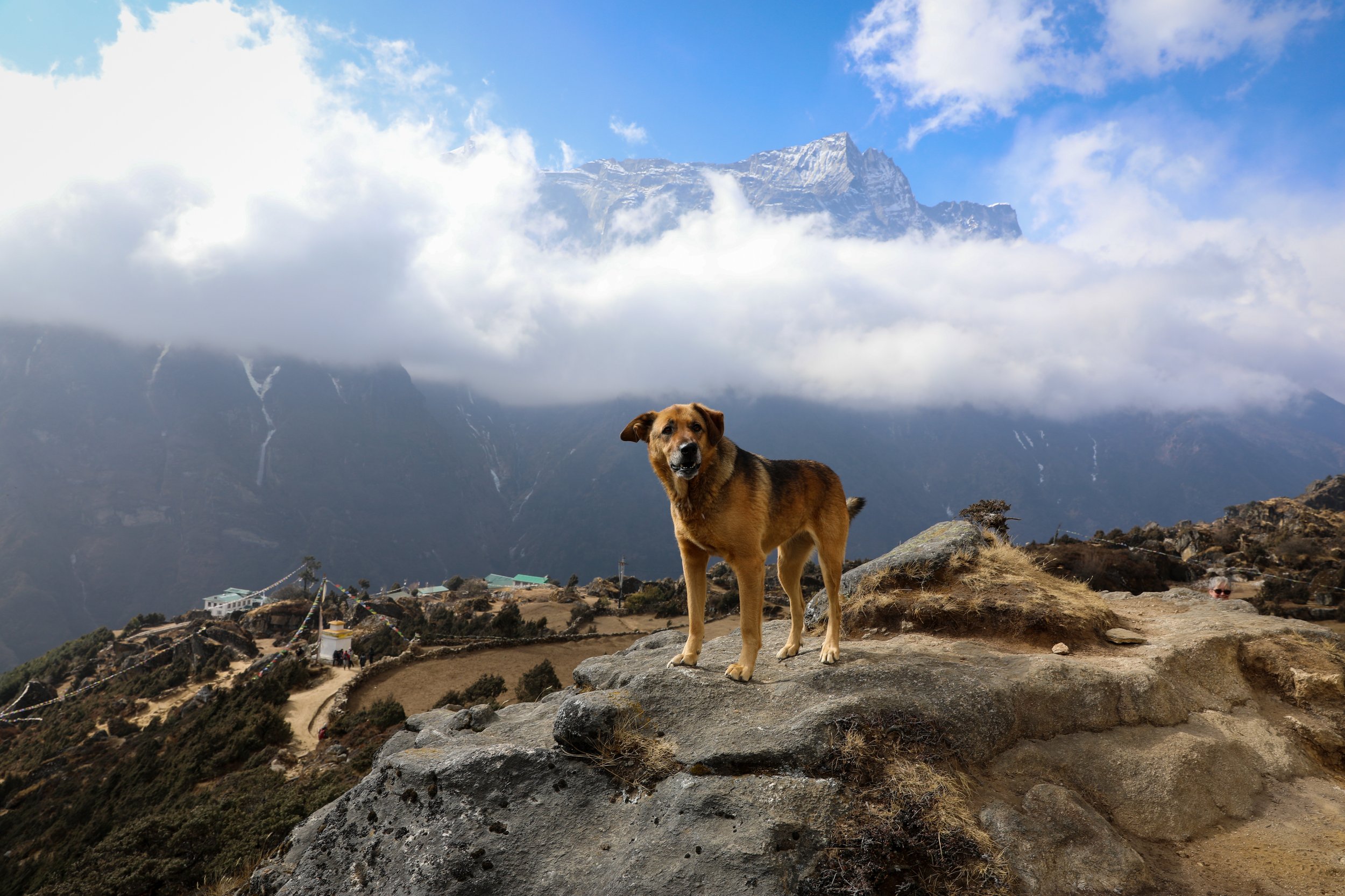
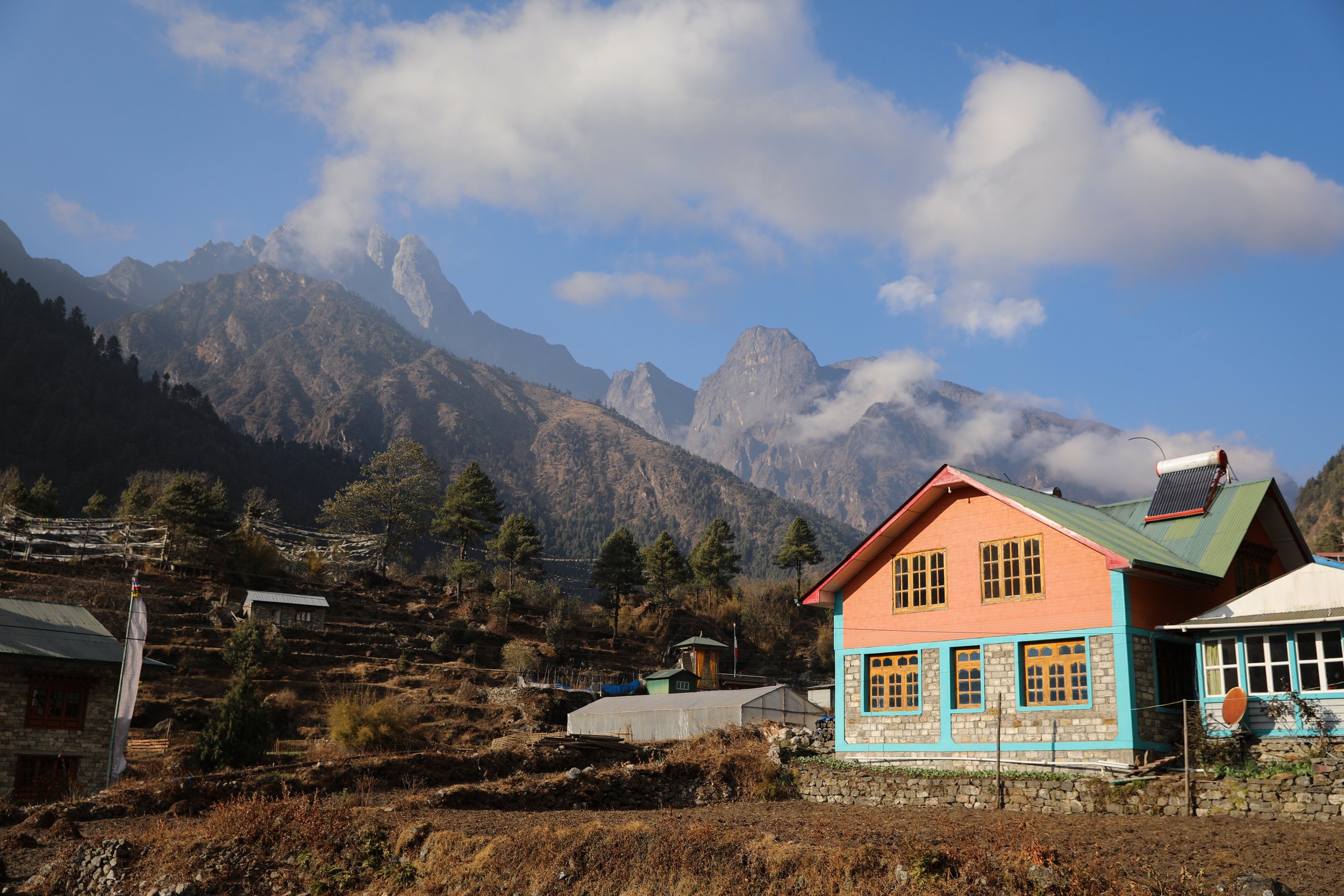
Namche Bazaar is a crucial stop for trekkers on route to EBC providing the last opportunity to buy crucial supplies (toiletries, medicine, clothing), exchange cash, or use an ATM. Prices for goods and services also increase exponentially beyond this point.

View of Kangtega at the back of Namche Bazaar
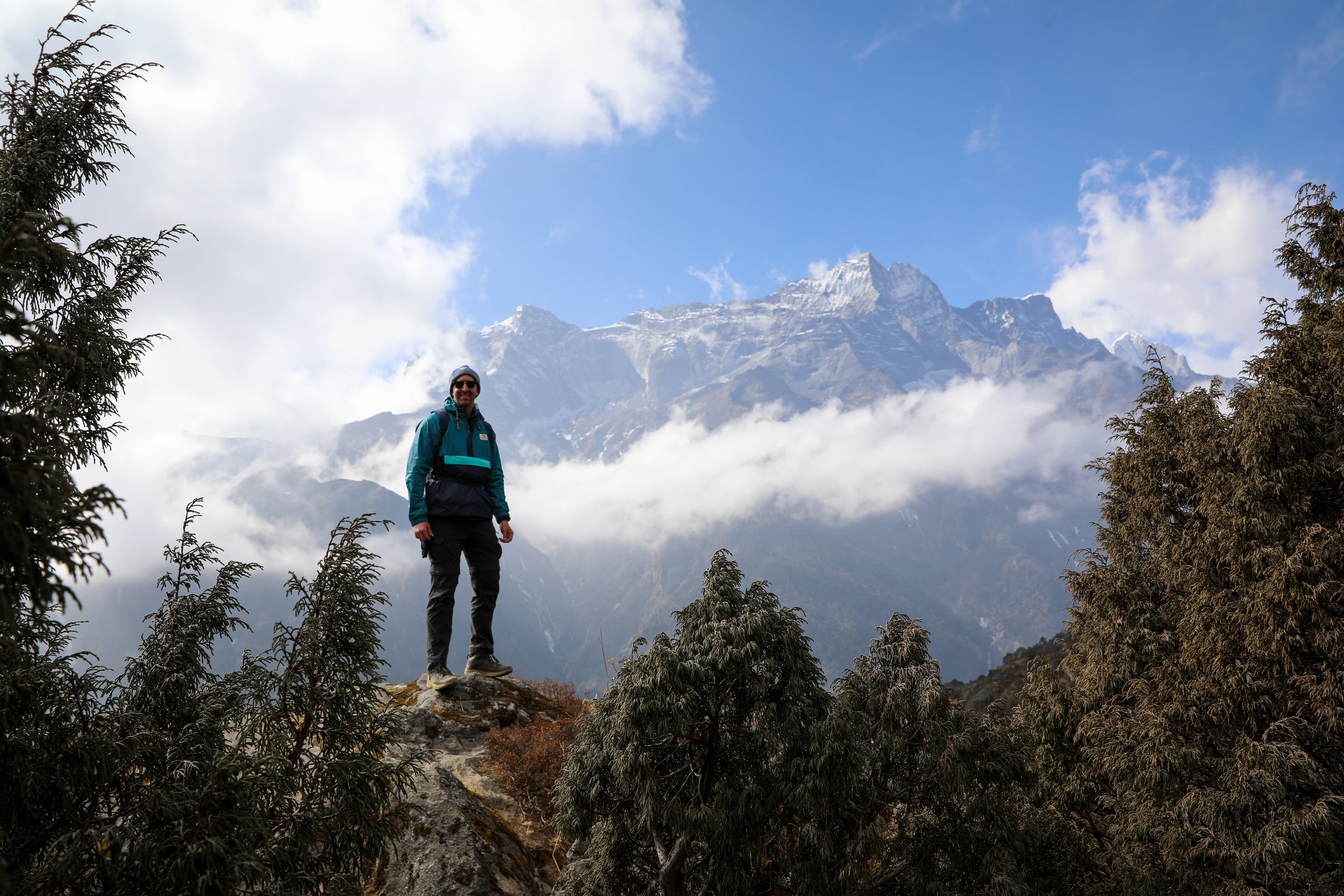
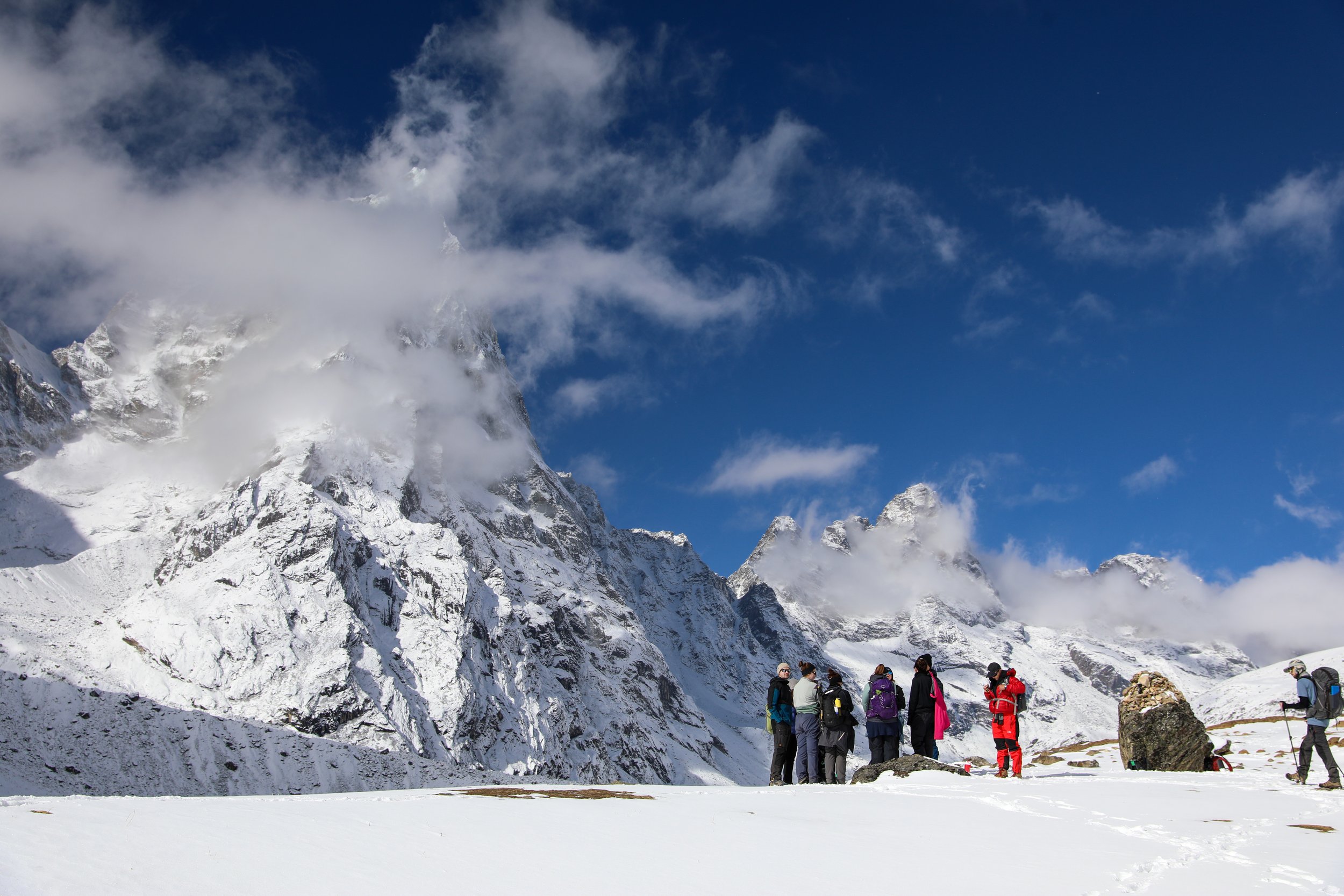
Day 3: Syangboche Acclimatisation Hike
Summary: depart from the accomodation in Namche Bazaar for an acclimitisation hike up to Syangboche. Along the way stop in at the Sagarmatha National Park Museum and the Tenzing Norgay Memorial.
Total Hiking Distance: 6 km
Total Hiking Duration: 3 hours
Accomodation: stay in Namche Bazaar
Highlights: capture the first glimpse of Mount Everest, Lhoste, Ama Dablam, Thamserku and Kongde Ri as you hike up Syangboche for the acclimatisation hike.
Day 3 Overview:
Hike Syangboche Round Trip Namche Bazaar
Depart: Namche Bazaar I Google Maps
Arrive: Syangboche Viewpoint I Google Maps
Trailhead: Follow signs from central Namche Bazaar to Syangboche
Total Hiking Distance: 6 km steep hike I round-trip
Total Hiking Duration: 3 hour hike I round-trip
Difficulty: Hard
Altitude: 3,860 meters above sea level
On the way up stop at the Sagarmatha National Park Museum and Tenzing Norgay Memorial. The museum has detailed sections on Sherpa culture, biodiversity of the region as well as Everest trekking history.
This location also offers a great viewpoint of the wider Himalayas including clear views of Mount Everest, Lhotse, Ama Dablam, and Thamserku on clear days.
This view only improves after completing the steep hike up to Syangboche an ideal location to properly acclimatise.
Viewpoint from Syangboche Hike
Day 4: Tengboche
Summary: the trek begins with a relatively easy and panoramic stretch, offering stunning views of peaks like Ama Dablam, Lhotse, and Everest. After crossing the Dudh Koshi River via a suspension bridge, the trail ascends steeply through a dense pine and rhododendron forest up to Tengboche, a small town home to a beautiful monastery.
Total Hiking Distance: 10 km
Total Hiking Duration: 6 hours
Accomodation: stay in Tengboche
Highlights: hiking alongside the Dudh Koshi river with views of Ama Dablam. Reaching the Tengboche Monastery.
Day 4 Overview:
Hike from Namche Bazaar to Tengboche
Depart: Namche Bazaar I Google Maps
Arrive: Tengboche I Google Maps
Trailhead: Follow signs from central Namche Bazaar to Tengboche
Total Hiking Distance: 10 km steep hike I one-way
Total Hiking Duration: 6 hour hike I one-way
Difficulty: Hard
Altitude: 3,810 meters above sea level
This is a tough day of hiking with some steep uphill sections with limited views, however the reward for reaching Tengboche is well worth the grind.
Tengbboche Monastery is the largest monastery in the Khumbu region and a spiritual hub for Sherpa culture
The monastery is of traditional Tibetan Buddhist design with intricate carvings and colourful paintings and offers an opportunity to witness prayer ceremonies on a daily basis for a small fee.
If you choose to enter the monastery note that there is a requirement to remove your shoes and remain respectful.
Hikers and Ama Dablam
Day 5: Ama Dablam and Dingboche
Summary: the trek from Tengboche to Dingboche takes approximately 5–6 hours, ascending through alpine terrain and past Pangboche village, with stunning views of Ama Dablam and the Imja Valley. At 4,410 meters, Dingboche serves as a key acclimatisation stop, offering trekkers a chance to rest, explore, and prepare for the higher-altitude stages of the Everest Base Camp trek.
Total Hiking Distance: 12 km
Total Hiking Duration: 5.5 hours
Accomodation: stay in Dingboche
Highlights: Incredible views of Ama Dablam.
Day 5 Overview:
Hike from Tengboche to Dingboche
Depart: Tengboche I Google Maps
Arrive: Dingboche I Google Maps
Trailhead: Follow signs from central Tengboche to Dingboche
Total Hiking Distance: 12 km moderate uphill hike I one-way
Total Hiking Duration: 5.5 hour hike I one-way
Difficulty: Moderate
Altitude: 4,410 meters above sea level
This is one of the most scenic days of the trek with incredible views of Ama Dablam throughout the journey.
The landscape also changes dramatically as the trail progresses out of the tree line uncovering an open baron rocky and rugged scene.
Arrival in Dingboche is greeted by stunning views of Ama Dablam, Lhotse, and the Imja Glacier, nestled in the Imja Valley.
Altitude sickness also starts to set in around this elevation, so be sure to take it easy and watch for any early signs.
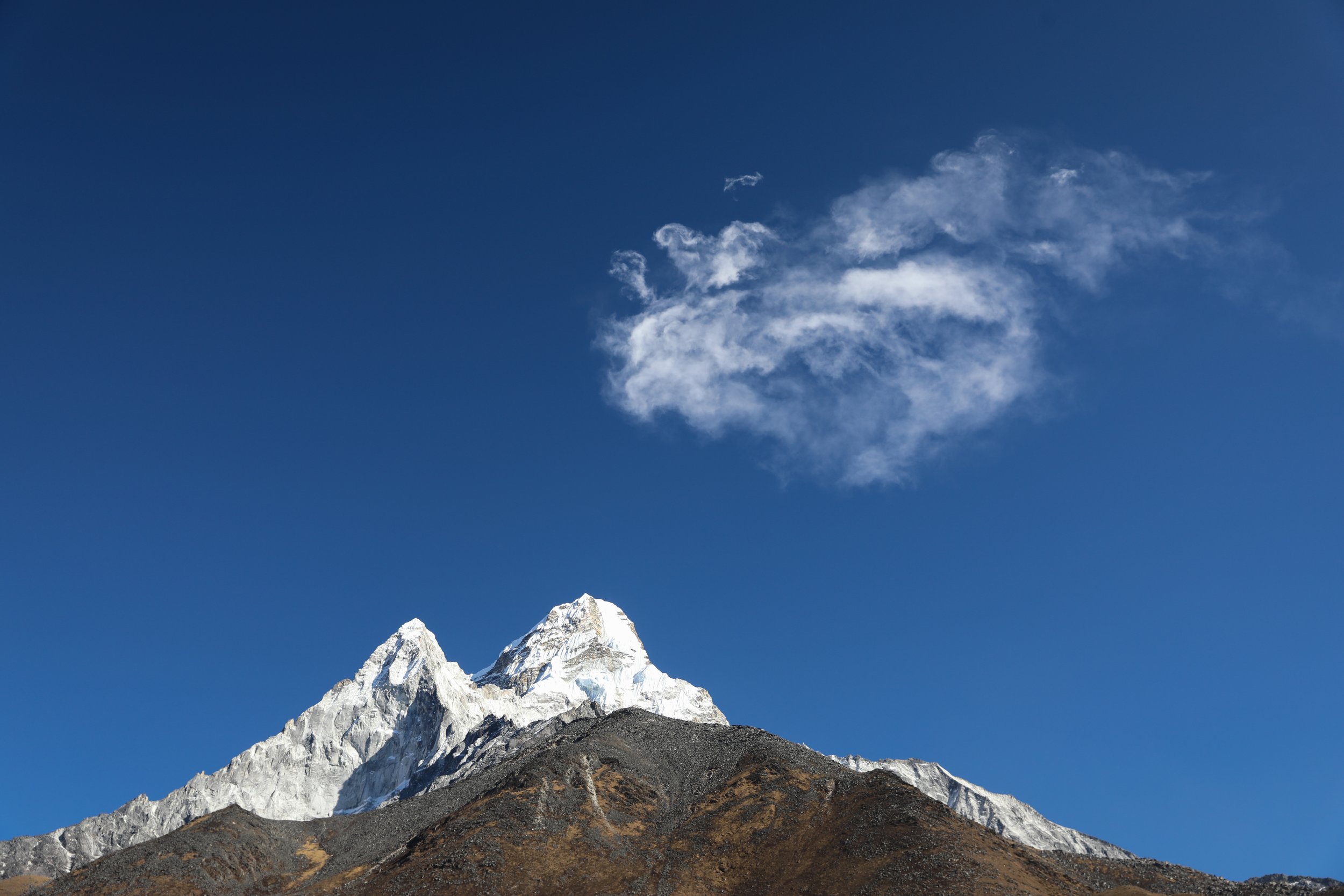
Ama Dablam and Cloud Formation
Day 6: Nagarzhang Peak Acclimatisation Hike
Summary: the Nagarzhang Peak acclimatization hike from Dingboche ascends to approximately 4,700 meters, offering breathtaking panoramic views of Ama Dablam, Makalu, and the Imja Valley. This steep 2 hour hike helps trekkers adapt to the altitude while experiencing some of the most stunning vistas of the Everest region.
Total Hiking Distance: 1 km
Total Hiking Duration: 3 hours
Accomodation: stay in Dingboche
Highlights: Views of Ama Dablam, Makula and the Imja Valley.
Day 6 Overview:
Acclimatisation Hike to Nagarzhang Peak
Depart: Tengboche I Google Maps
Arrive: Dingboche I Google Maps
Trailhead: Follow signs from central Tengboche to Dingboche
Total Hiking Distance: 1 km steep uphill hike I round-trip
Total Hiking Duration: 3 hour hike I round-trip
Difficulty: Hard
Altitude: 4,700 meters above sea level
A very steep hike part way up to the Nagarzhang Peak to aid with acclimatisation.
The viewpoint offers incredible 180 degree views of Ama Dablam, Makula and the Imja Valley.
Todays hike is designed to be taken slowly with a pure focus on building up resilience.

Nagarzhang Peak
Day 7: Everest Memorial and Lobuche
Summary: the trek from Dingboche to Lobuche, at 4,940 meters, takes 5–6 hours and passes through the windswept Thukla Pass, marked by memorials to climbers who lost their lives in the Himalayas. The trail offers increasingly rugged terrain with breathtaking views of Nuptse and Pumori, as trekkers prepare for the final stretch to Everest Base Camp.
Total Hiking Distance: 11 km
Total Hiking Duration: 6 hours
Accomodation: stay in Lobuche
Highlights: Views of Nuptse and Pumori peaks as well as a visit to the Everest memorial.
Day 7 Overview:
Hike from Dingboche to Lobuche
Depart: Dingboche I Google Maps
Arrive: Lobuche I Google Maps
Trailhead: Follow signs from Dingboche to Lobuche
Total Hiking Distance: 11 km moderate uphill hike I one-way
Total Hiking Duration: 6 hour hike I one-way
Difficulty: Moderate
Altitude: 4,940 meters above sea level
The climb through the Thukla Pass is both poignant and scenic, with dramatic glacial landscapes and climber memorials set against a backdrop of jagged ridges and snow-capped summits, immersing trekkers in the grandeur of the high Himalayas.
Dughla provides a quick rest stop part way along the journey, potentially a much needed reprieve out of the elements.
Hike to Lobuche
Day 8: Gorakshep and Everest Base Camp
Summary: The trek from Lobuche to Everest Base Camp (5,364 meters) is a challenging 7–8 hour day, including a stop at Gorak Shep (5,164 meters) for a brief rest. The trail follows the Khumbu Glacier's rugged moraine, with stunning views of Nuptse, Pumori, and the Khumbu Icefall, before culminating in the surreal experience of reaching the iconic Everest Base Camp amidst towering peaks and vast glaciers.
Total Hiking Distance: 14 km
Total Hiking Duration: 8 hours
Accomodation: stay in Gorakshep
Highlights: Incredible views of Nuptse, Pumori and the Khumbu Icefall topped of with reaching Everest Base Camp.
Day 8 Overview:
Hike from Lobuche to Everest Base Camp
Depart: Lobuche I Google Maps
Arrive: Everest Base Camp I Google Maps
Trailhead: Follow signs from Lobuche to EBC
Total Hiking Distance: 14 km moderate uphill hike I one-way
Total Hiking Duration: 8 hour hike I one-way
Difficulty: Hard
Altitude: 5,300 meters above sea level
Depart Lobuche and pass through Gorak Shep, the final settlement before Base Camp.
Everest Base Camp is marked by colourful prayer flags and the famous marked rock, iconic for a photo of the achievement.
This final push to the end of this incredible hike is tough, with freezing temperatures and added effects of altitude sickness but it is completely worth the struggle.
After reaching the pinnacle of the hike, there’s a decent walk back down to Gorak Shep to take the whole experience in.

Everest Base Camp
Day 9: Pheriche
Summary: the trek from Gorak Shep (5,164 meters) to Pheriche (4,371 meters) is a challenging 7-8 hour journey, descending through the rocky trails of Lobuche and the Thukla Pass. The route offers stunning views of towering peaks and glacial landscapes, with a noticeable shift to lower altitudes where breathing becomes easier and the environment feels more hospitable.
Total Hiking Distance: 15 km
Total Hiking Duration: 8 hours
Accomodation: stay in Pheriche
Highlights: Incredible views of Cholaste, Ama Dablam, Taboche and Pumore during the descent through Thukla Pass.
Day 9 Overview:
Hike from Gorak Shep to Pheriche
Depart: Gorak Shep I Google Maps
Arrive: Pheriche I Google Maps
Trailhead: Follow signs from Gorak Shep for the descent
Total Hiking Distance: 15 km moderate mostly downhill hike I one-way
Total Hiking Duration: 8 hour hike I one-way
Difficulty: Moderate
Altitude: 4,371 meters above sea level
Depart Gorak Shep for the first initial descent back down through Lobuche on the way to Pheriche.
The stunning scenery continues to impress with clear views of Cholaste, Ama Dablam, Taboche and Pumore

Snow Covered Hut
Day 10: Pangboche and Khumjung
Summary: the trek from Pheriche (4,371 meters) to Khumjung (3,840 meters) is a scenic and varied 6–7 hour day, gradually descending through alpine meadows and rhododendron forests. The route passes through Pangboche and Tengboche, offering breathtaking views of Ama Dablam, Everest, and Thamserku, while the lower altitude brings a welcome sense of ease and rejuvenation.
Total Hiking Distance: 17 km
Total Hiking Duration: 7 hours
Accomodation: stay in Khumjung
Highlights: views of Ama Dablam and Thamserku as you descend.
Day 10 Overview:
Hike from Pheriche to Khumjung
Depart: Pheriche I Google Maps
Arrive: Khumjung I Google Maps
Trailhead: Follow signs from Pheriche back down to Khumjung
Total Hiking Distance: 17 km mostly downhill with some steep uphill sections l hike I one-way
Total Hiking Duration: 7 hour hike I one-way
Difficulty: Hard
Altitude: 3,840 meters above sea level
The hike passes through Pangboche the oldest Sherpa village in the region with stunning views of Ama Dablam.
Along the trail you will descend back down into the thick Rhododendron and Pine Forests, which is a stark contrast to alpine terrain of earlier parts of the trip.

Porter Leaving Tengboche
Day 11: Monjo
Summary: The trek from Khumjung (3,840 meters) down to Monjo (2,835 meters) via Namche Bazaar is a rewarding 4–5 hour journey, descending through a mix of terraced fields, pine forests, and charming mountain villages. The route offers spectacular views of Thamserku and Kongde Ri, with Namche Bazaar providing an opportunity to enjoy the vibrant heart of the Khumbu region. As you continue downhill, the landscape transitions into lush greenery, with the Dudh Kosi River guiding the way. This stretch combines cultural encounters, serene natural beauty, and a sense of accomplishment as the altitude eases.
Total Hiking Distance: 9 km
Total Hiking Duration: 5 hours
Accomodation: stay in Monjo
Highlights: Incredible views of Dudh Kosi River and Thamserku.
Day 11 Overview:
Hike from Khumjung to Mono
Depart: Khumjung I Google Maps
Arrive: Monjo I Google Maps
Trailhead: Follow signs from Khumjung to Monjo
Total Hiking Distance: 9 km downhill hike I one-way
Total Hiking Duration: 5 hour hike I one-way
Difficulty: Easy
Altitude: 2,835 meters above sea level
Depart Khumjung for a short hike to Namche Bazaar. This is a great opportunity to pick up some souvenirs to remember your epic adventure by.
As you leave Namche you will again pass over the Hillary Bridge and get one final glimpse of Mount Everest.
By the end of the hike you will have descended around 1,000m marking a noticeable difference in the concentration of oxygen in the air. Those that have felt unwell throughout the journey will likely notice a huge improvement.

Mules Transporting Supplies
Day 12: Return to Lukla
Summary: The trek from Monjo (2,835 meters) to Lukla (2,860 meters) is a pleasant 6 hour walk, weaving through dense pine forests, suspension bridges, and picturesque villages. Following the Dudh Kosi River, the trail gently ascends and descends, with charming stops like Phakding offering a final glimpse of the Khumbu’s traditional teahouses. The journey is filled with moments to reflect on the adventure, as the bustling hub of Lukla marks the end of the trek.
Total Hiking Distance: 16 km
Total Hiking Duration: 6 hours
Accomodation: stay in Lukla
Highlights: final views of the picturesque Himalayan Region
Day 12 Overview:
Hike from Monjo to Lukla
Depart: Monjo I Google Maps
Arrive: Lukla I Google Maps
Trailhead: Follow signs directing you back to Lukla
Total Hiking Distance: 16 km moderate undulating hike I one-way
Total Hiking Duration: 6 hour hike I one-way
Difficulty: Hard
Altitude: 2,860 meters above sea level
Today has a lot more uphill sections then you likely would have remembered on your first day and these are not to be underestimated.
The terrain is varied but manageable, with the surrounding greenery and mountain vistas providing a fitting farewell to the Everest region.
The final arrival in Lukla is a bittersweet moment, with pure gratitude from your legs that you can finally stop walking, but raw emotions around the trip coming to an end.
The following morning you will fly back out to Kathmandu concluding your time in the Himalayas.
Tea House in the Hills of Nepal
Embark on an extraordinary 12-day trek to Everest Base Camp, starting with a thrilling flight to Lukla the most dangerous airport in the world. Trek through the enchanting Sherpa villages of Phakding and Namche Bazaar, immersing yourself in the culture and scenery. As you climb higher, pass through Tengboche, the spiritual heart of Sagarmatha National Park, where breathtaking views of Mount Everest, Ama Dablam, and the majestic peaks of the Himalayas surround you at every turn.